JalSmriti
A public website that reads forty years of satellite data for any address in India and Nepal, and tells a family renting, buying or living there what the ground remembers about water.
Overview
Indian cities flood where their lakes used to be. The record of where water lived sits in satellite archives that only specialists read, so a family choosing a flat gets no plain answer.
JalSmriti reads that record for one address in two to four minutes: whether the street was once a tank bed, how the ground drains, whether monsoon radar has seen water standing there, and how hot it gets in summer. Four taps turn it into a verdict for renting or buying, with every reason shown. Lake groups can turn verified photos into a signed complaint that any office can check.
I built it solo, from the satellite pipeline to the website. It deploys into a new AWS account with one command.
What a family sees
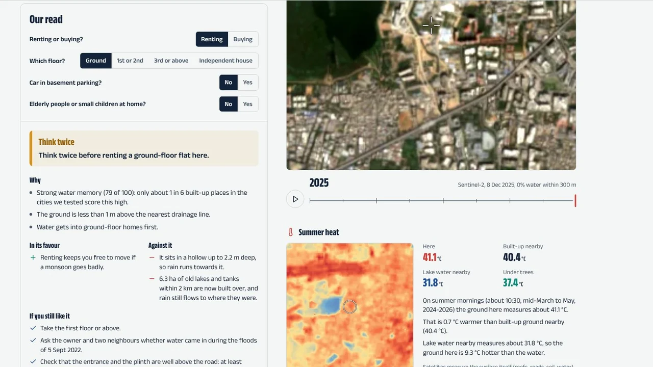 Our read for a ground-floor flat at Bellandur
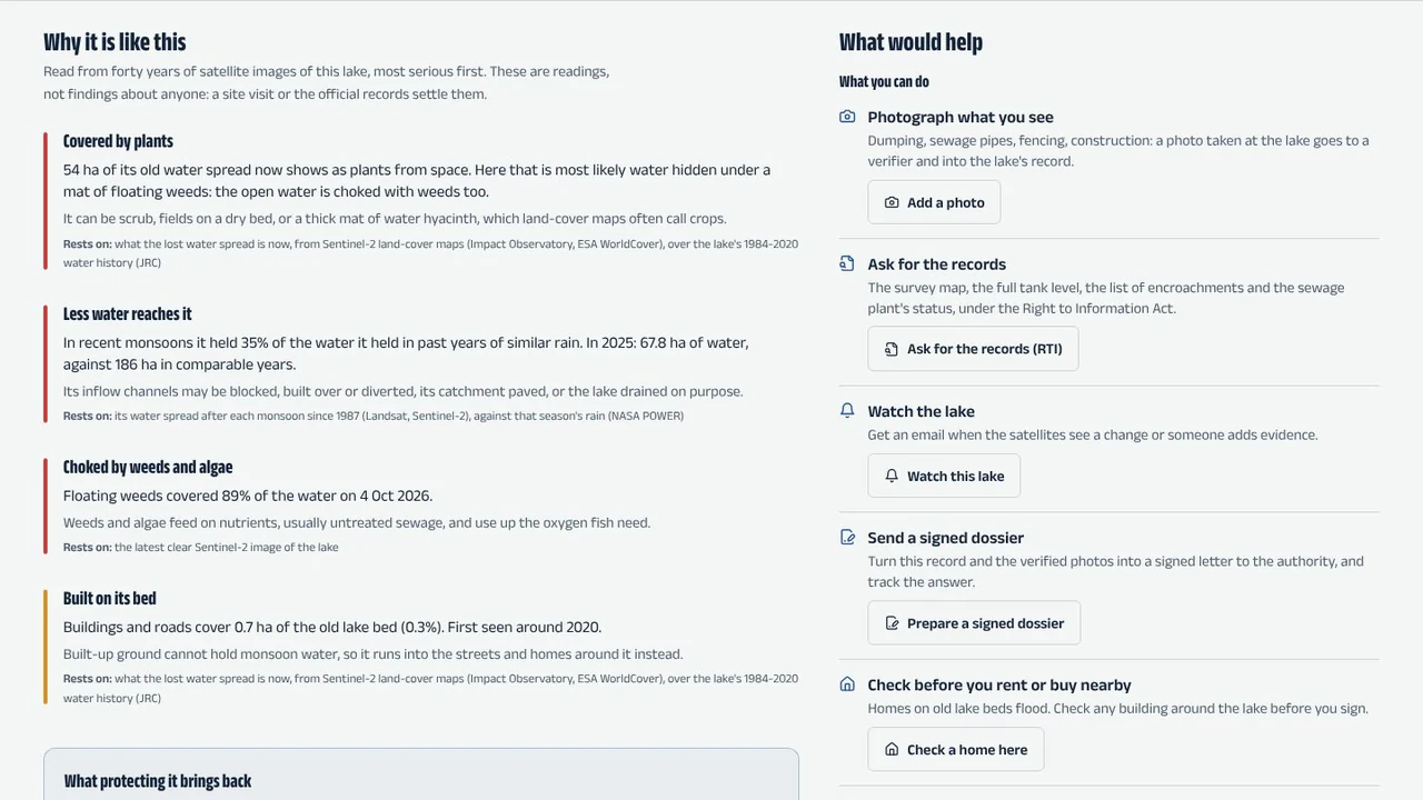 Why Bellandur Lake is like this
Checking a place
One address runs as a Step Functions workflow. Four branches read the satellite record in parallel, and the page fills in as each one finishes:
Static
Water history since 1984 from JRC Global Surface Water, land cover, and the shape of the ground from the Copernicus DEM: hollows, drainage lines and how far the street sits above them.
Optical
A time-lapse of the same spot since 1990 from Landsat and Sentinel-2.
Radar
Every Sentinel-1 radar pass since 2017 that saw unusual standing water in the monsoon, when clouds blind optical satellites.
Heat
Landsat 8 and 9 surface temperature on summer mornings, next to built-up ground, lake water and trees nearby.
Score
The branches join into one water memory score and its findings, stored once in DynamoDB, so the page, the signed PDF and the narration never disagree.
Satellite data, never copied
GDAL reads only the windows it needs from cloud-optimised GeoTIFFs over HTTPS: Sentinel-2 and the Copernicus DEM from the Registry of Open Data on AWS, and Landsat, Sentinel-1, JRC Global Surface Water and land cover from Microsoft Planetary Computer.
A whole city is a Step Functions Distributed Map over post-monsoon scenes since 1987, so nine areas and 1,138 water bodies are graded A to E without storing a single scene.
From a record to action
Each step uses the AWS service built for it:
- A signed place report: a PDF in the reader’s language, signed with a key held in AWS KMS, that anyone can verify in their own browser.
- Reports read aloud in Hindi or English by Amazon Polly.
- A rain heads-up: EventBridge Scheduler checks the forecast every morning, and Amazon SNS emails the people who follow a place.
- Photos as evidence: Amazon Rekognition reads printed words and labels, and Amazon Nova on Amazon Bedrock checks that it is a real photo taken at the lake, so screenshots and posters are refused.
- A complaint letter drafted by a Strands agent on Amazon Nova from computed facts only, translated, rendered as a PDF and signed, with a Right to Information request one tap away.
- A review console where 16 Cedar rules decide what NGO verifiers and officers can do, with every decision logged.
Does it work?
I checked what it says about places that flooded against ordinary built-up places:
| Places checked | What JalSmriti says |
|---|---|
| 240 ordinary built-up places (validation set) | Warns at 53% |
| 39 flooded localities (validation set) | Warns at 82% |
| 16 places that flooded, 2020 to 2026 | Think twice or look elsewhere for a ground-floor renter at 14 |
From the project’s case studies and validation set. It flags half of ordinary places too, so it is a nudge to check before signing, not a ban.